

About Gleeson Land
Gleeson Land is part of MJ Gleeson, a housebuilder and strategic land specialist. Established in the 1990s, Gleeson has been creating new homes and community facilities for local people for almost 120 years. The Strategic Land division is a land promotion business and is focused on securing mainly residential planning consents, predominantly in Southern and Central England.
Gleeson Land is committed to realising the development potential of land in sustainable locations to provide high quality new homes in attractive environments where people want to live and relax. They are passionate about making a difference through creating sustainable places and will apply these same core principles to development at this site.
More details about the company can be found on the website.

Site Location
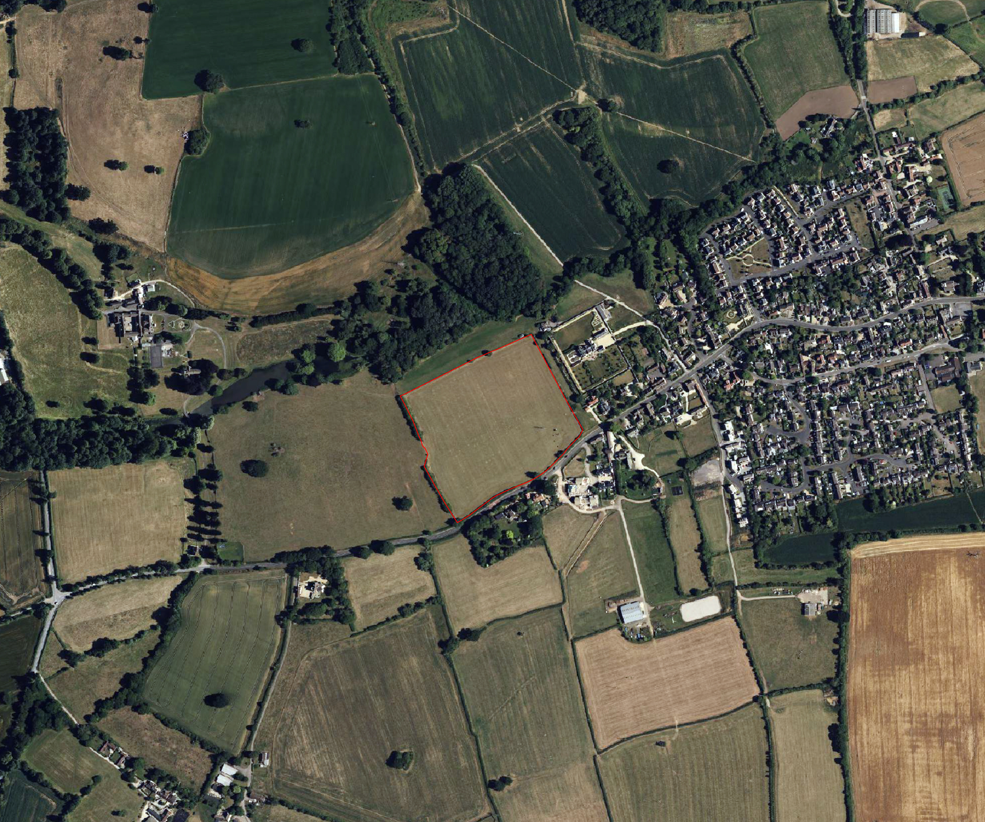
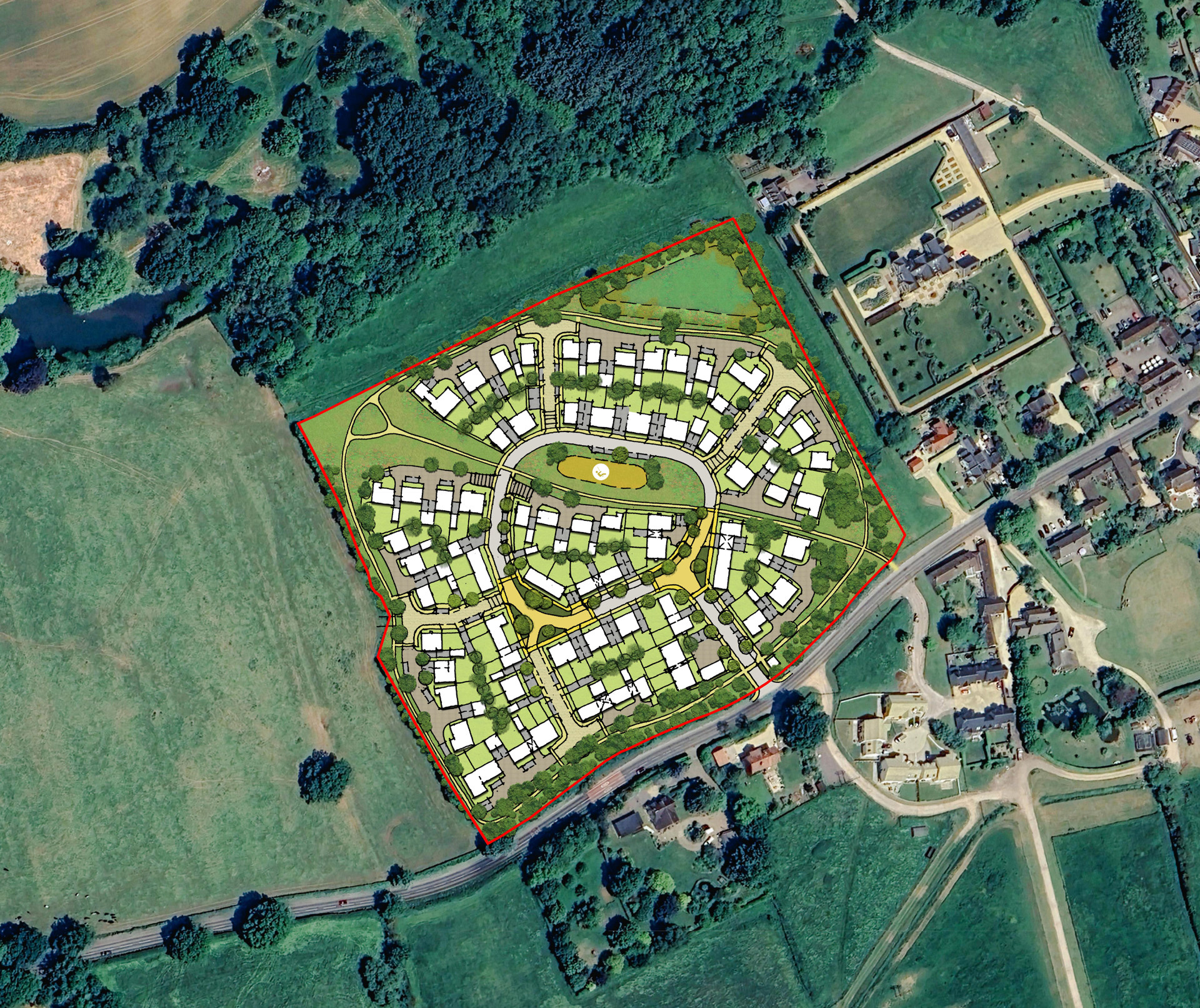
The site is situated to the north-western edge of Sutton Benger.
The land is bounded by High Street to the south, existing private track and dwellings to the east, the ‘Shrubbery’ woodland and strip of land to the north, and a field to the west. The site is approximately 4.95 hectares (12.23 acres) in size.
-
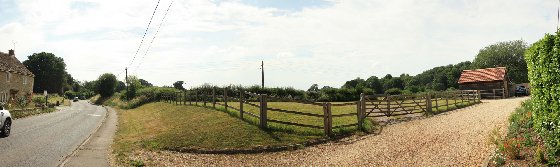
Existing site photo
-
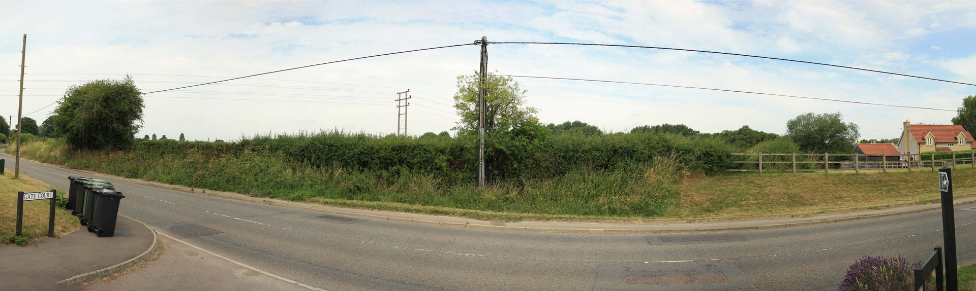
Existing site photo
-
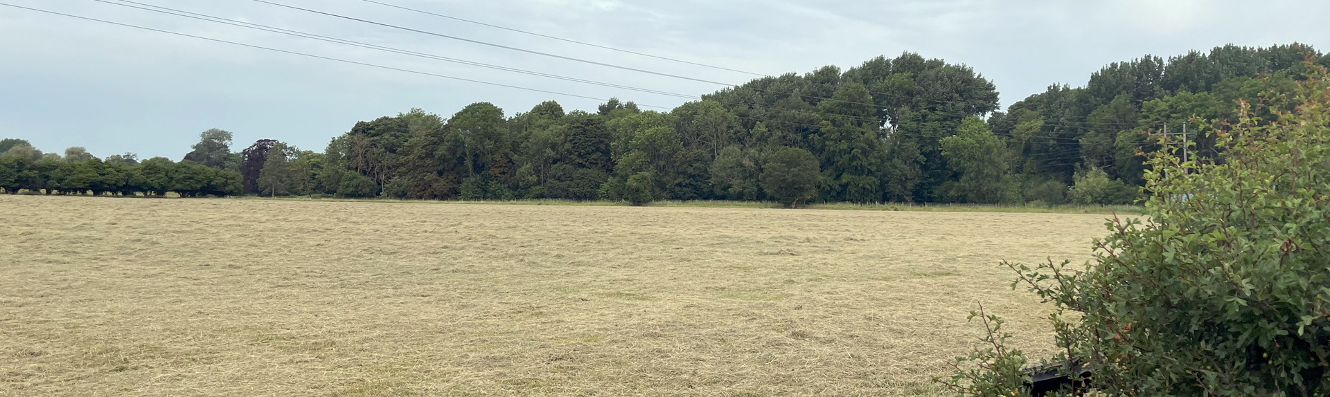
Existing site photo
Our Proposal
Gleeson Land are developing proposals with a view to submitting an outline planning application for new homes and public open space on Land at Gate Farm, Sutton Benger, and would like to hear your comments.
Our vision for the development is to create a high-quality environment with well-designed buildings, spaces, and public open space.
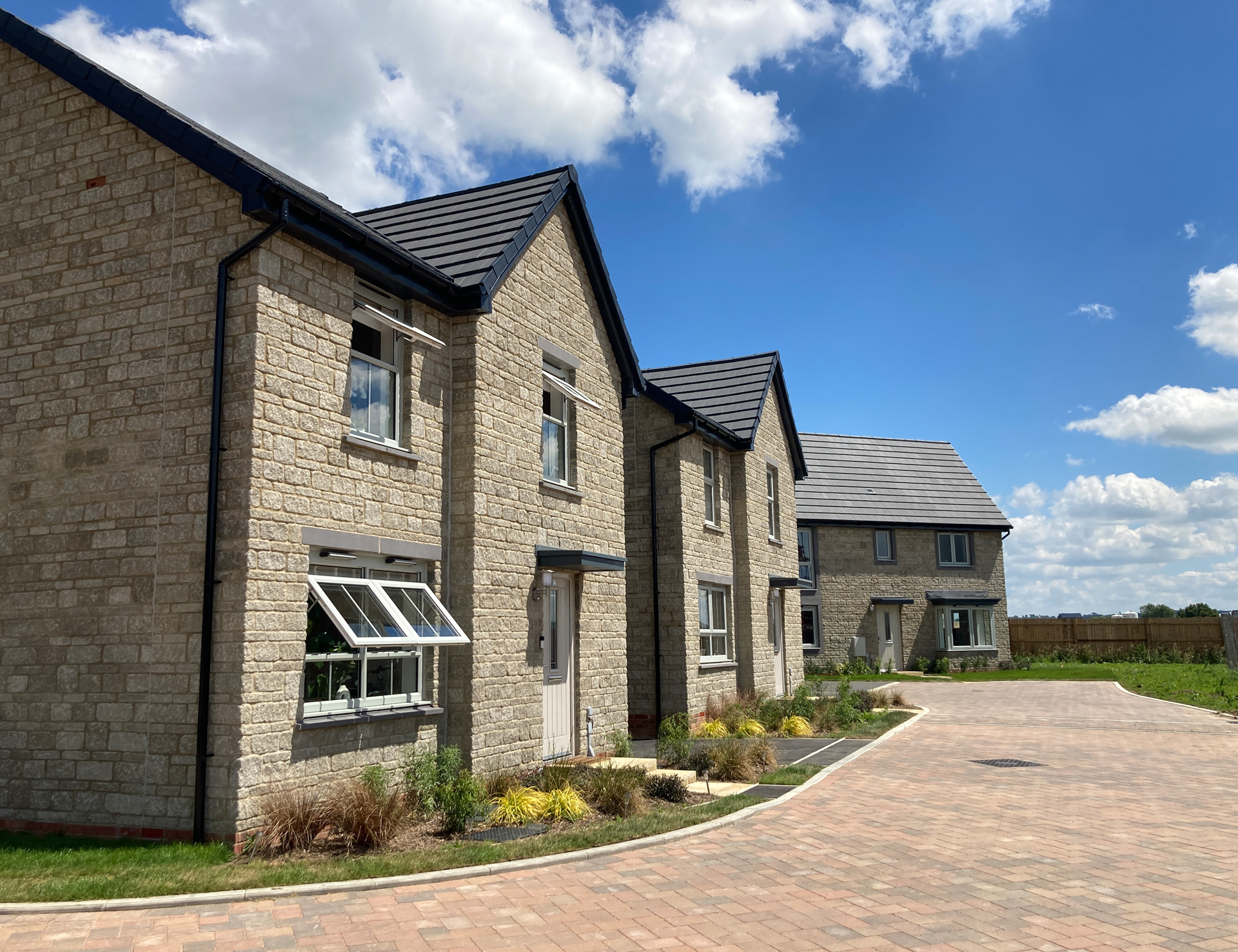
The design of the buildings will not be fixed at this stage but these examples show how the development might look.
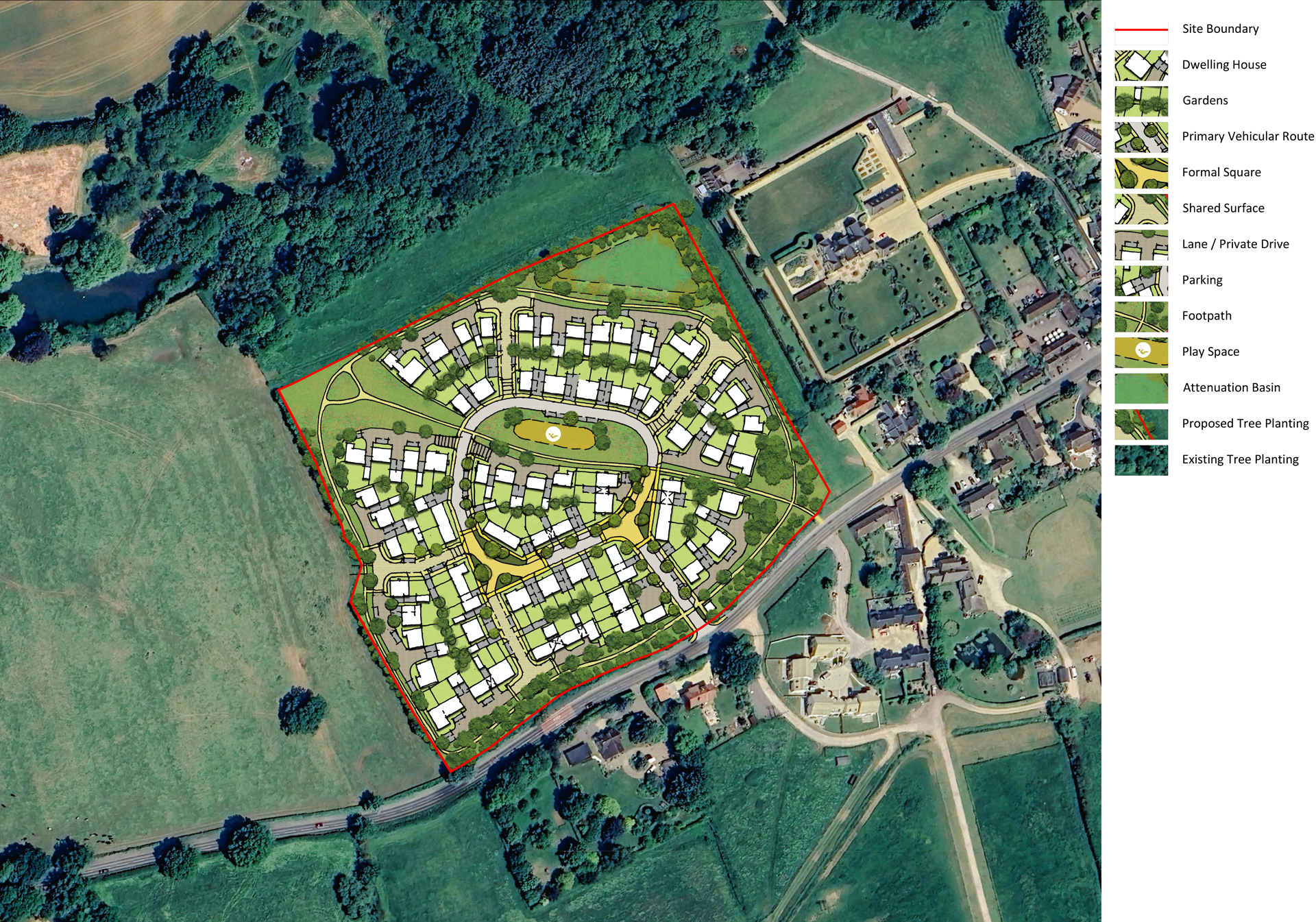
As the proposals will be brought forward in outline form, the detailed matters relating to design and layout will be addressed at a later date. However, our emerging illustrative masterplan shows one way that the new homes, access routes and public open space could be delivered within the site.
Key features of the proposal (as it is illustratively shown here) are as follows:
- A mix of 1, 2, 3, and 4 bedroom homes to meet a wide range of housing needs, including provision of 40% affordable homes.
- The new homes will be mainly 2 storeys with the potential for a small number of 2.5 storeys (i.e. accommodation in the roof) and will be of a high-quality design, which complements and reflects the existing character of the local area.
- Vehicular, pedestrian, and cycle access from High Street.
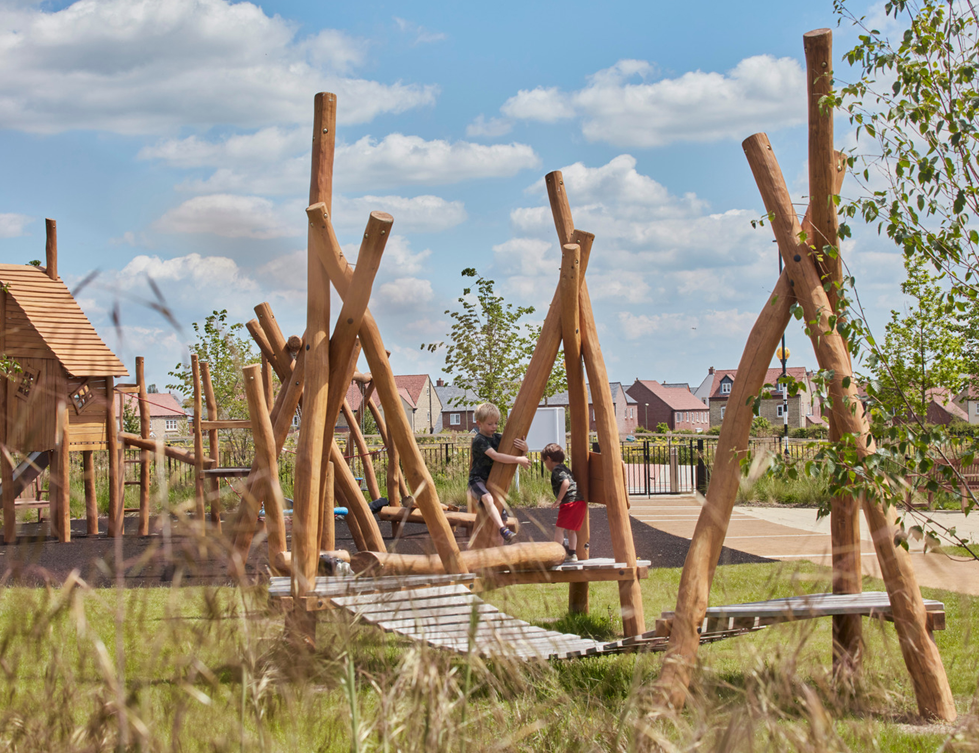
- Provision of public open space which would accommodate an equipped play area and offer a variety of different areas for recreation and relaxation linked by a network of footpaths/cycleways.
- A new sustainable drainage system that naturally manages the surface water run-off.
- Retention of important trees and hedgerows within the site and on its boundaries with new planting to reinforce the landscaped edges to the site and ensure there are no adverse effects on ecology, providing a net gain in biodiversity.
Landscape and Ecology
To inform development at Land at Gate Farm, technical analysis in relation to landscape character and visual matters has been undertaken.
To aid in the assimilation of the proposals into the existing landscape and visual context, the following design approach recommendations were provided:
- Existing Hedgerow Network: Masterplanning should encourage and maintain the existing hedgerow network present around the Site where possible and replace any incomplete or missing gaps within the provision. This will help to ensure that this characteristic feature is retained and continues to provide a connected green infrastructure resource through the landscape.
- Hedgerow Trees: Protect and encourage the provision of hedgerow trees along the existing hedgerow network. Existing hedgerow trees should be retained with opportunities for further planting sought to increase their presence in the landscape.
- Street Tree Planting: The planting of new street trees within the scheme is supported by national policy and would help to soften and break up the appearance of built form and aid in the assimilation of the proposals within the characteristically well vegetated landscape.
- Public Access: The Site is currently private with no public access. There is an opportunity to create circular walks through the development alongside public open space. This would increase permeability within the area and enhance green infrastructure provision and connectivity.
- Play Space: The creation of a play space within the scheme would promote activity and play. Natural surveillance would be provided by surrounding properties.
- Development Setback: Built form should be set back from the edges of the Site to provide space for new planting, public use and to soften the appearance of development on the approaches to the Site.
- Active Frontages: Masterplanning should encourage outward facing development to provide a positive approach to the development with no back gardens and close board fencing facing the wider landscape. This would also promote natural surveillance of public spaces.
- View Corridor: There is an opportunity to provide a publicly accessible viewing point to the northwest toward St James’ Church.
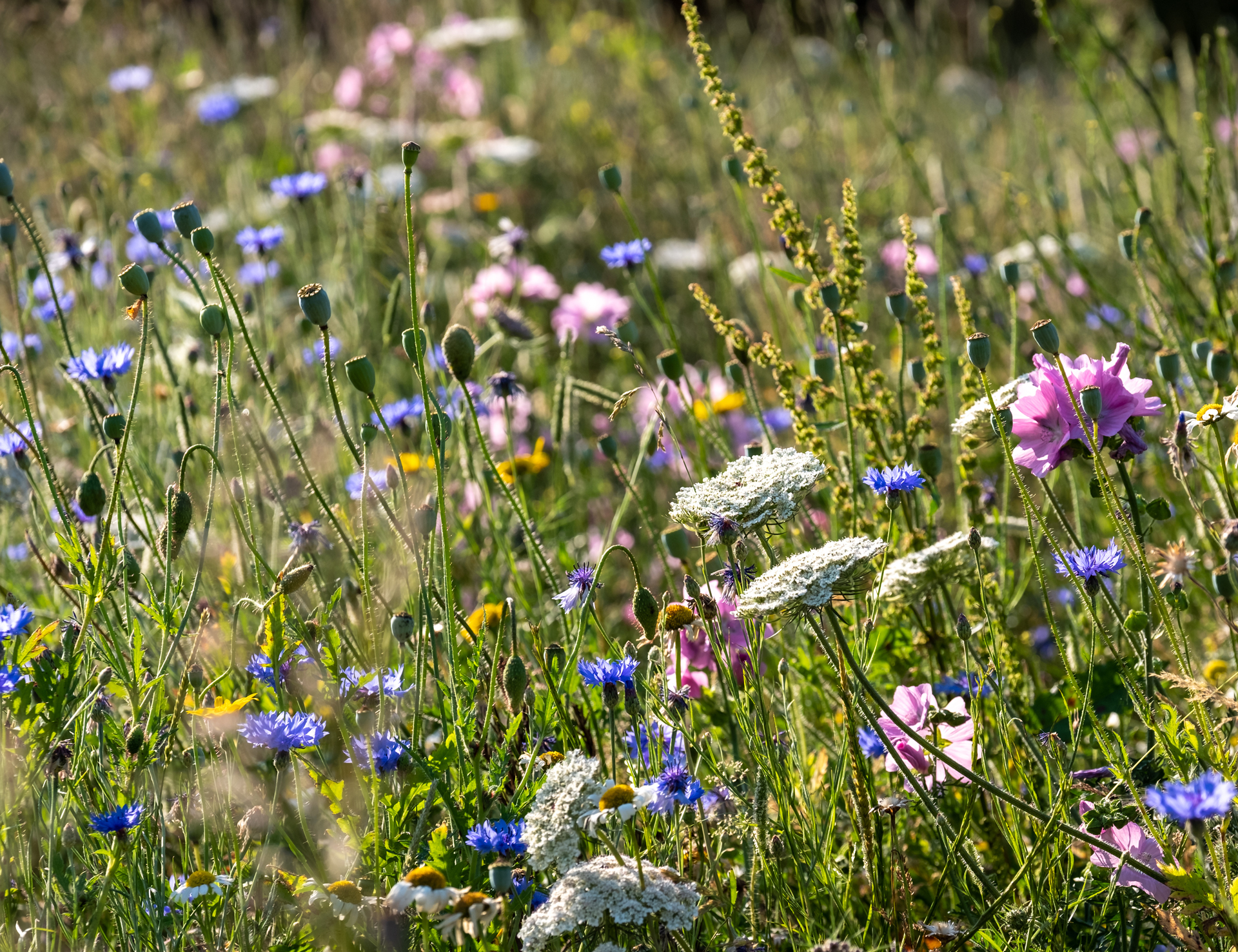
- Attenuation Features: These could be planted with wet grassland and marginal aquatic species to improve biodiversity. This planting would help to assimilate these features into the landscape, rather than providing purely engineered features.
The proposals will retain and enhance the majority of boundary hedgerows within the site. A green buffer at least 15 metres wide will be created between the development and the woodland and stream to the north; this will be kept ‘dark’ to maintain the value of these habitats to wildlife. The development will also deliver at least a 10% biodiversity net gain overall.

Arboriculture
LBS5837:2012 compliant Tree surveys have been undertaken to establish the arboricultural baseline of the Land at Gate Farm during June 2025, by an appropriately qualified arboricultural consultant.
This baseline tree survey will be used to inform the iterative design process, ensuring that existing trees are retained and integrated into the development and protected from impacts during the construction of the site. This, in turn, allows for the retention of the majority of trees within the site. The baseline tree survey also identifies locally appropriate species for tree planting within landscape buffers, greenspaces, alongside extensive street tree planting as supported by national policy. The prominent, high value woodland, located to the north of the development, will be protected by a buffer of at least 15 metres from the development to prevent any development encroachment into the root protection areas of the trees within the woodland, ensuring the long-term health of this valuable feature is preserved.
As the development process continues, a detailed arboricultural impact assessment shall be undertaken and submitted as part of the planning application. Furthermore, an arboricultural method statement will be produced ensuring that trees are appropriately protected and, where required, appropriately sensitive methodologies are adopted where the development conflicts with the existing trees.

Heritage
To inform our emerging proposals we have carefully considered the heritage and archaeology of the site and surrounding area.
Historic Context
- The site is currently pastureland with no listed buildings or structures within it.
- It lies next to, but outside, the Sutton Benger Conservation Area, which contains historic cottages, farmhouses and stone boundary walls that give the village its character.
Design Approach
- The proposed development keeps a green buffer and tree planting along the southern edge to maintain separation from the Conservation Area and protect the setting of nearby listed buildings.
- No development is proposed within the part of the site that formed the historic parkland.
- Future buildings would use materials and layouts sympathetic to the character of Sutton Benger, similar to recent developments such as Gate Court.
Archaeology
- Historic records show past activity in the area dating back to the prehistoric and medieval periods.
- A geophysical survey found no significant archaeological remains within the site, apart from traces of historic ridge-and-furrow cultivation.
- Any further investigation, if deemed necessary, will be agreed with Wiltshire Council’s archaeologist and carried out before development begins.

Access & Transport
The access design and location has been informed by a robust body of technical work and speed survey data. The site also already benefits from planning permission for an agricultural access from the B4069.
It is currently anticipated that the proposed development will be served by an enhanced access point in this location in order to accommodate residential development. Footways will also be provided on both sides of the access, which will tie into the existing footway provisions on the B4069 High Street to provide a continuous footway between the site boundary and the centre of the village.
There is a variety of existing facilities and amenities available in Sutton Benger including a village hall, park and recreation ground, doctors surgery, primary school, church, public house and restaurant. These are all within a suitable walking distance from the approximate site centre.
The nearest bus stops are located around 450 metres to the east of the approximate centre of the site. These are served by bus route 91, which provides a connection between Chippenham and Little Somerford.
The final submission will be supported by a Transport Assessment, which will assess the impact of the proposed development on the surrounding network and highlight the available sustainable travel options. The scheme will also be supported by a Framework Travel Plan that will aim to encourage residents to walk, cycle or use public transport.

Drainage
Flood risk and drainage have been carefully assessed as part of the proposals.
While the northern boundary of the site lies close to Sutton Benger Brook, the proposed new development will be located entirely within Flood Zone 1 (low risk).
A sustainable drainage system (SuDS) will be delivered across the site. This will control the flow of rainwater and restrict discharge from the development to existing greenfield rates. The system will:
- Restrict run-off to natural greenfield rates.
- Be designed with a 40% climate change allowance to future-proof the development.
- A 10% allowance for urban creep.
- Provide attractive landscaped basins and swales that double as wildlife habitats and green spaces.
- For foul drainage, the development will connect directly into the Wessex Water public foul sewer network which currently crosses the development.
Overall, these measures will ensure the development is safe from flood risk with no detrimental effect on any neighbouring development.

Sustainability
At Gleeson, sustainability means meeting the needs of the present without compromising future generations.
Sustainability is at the heart of our business, and our approach is based on our relationships with communities, people, and the environment.
Key features of the proposals will include:
- Highly energy efficient, climate adaptable, sympathetically designed homes
- Low carbon development from the outset
- A secure and identified trajectory to net zero emissions over time
- Dedicated EV charging points
- Reduction in potable water use
- Secure and weatherproof cycle storage

Benefits
We are still in the early design stages, with the final proposals to be confirmed at a later date, but our initial plans could provide:
- The provision of much-needed housing to address a significant shortfall in the district, designed to respond to local need.
- Up to 90 new homes will be proposed, offering a range of dwelling types, sizes and tenures (including affordable housing) to create an inclusive new community.
- Making most effective use of the land available on a site that forms a sustainable location and that is immediately adjacent and well related to the settlement of Sutton Benger.
- The adoption of a high quality and sustainable design approach to ensure the development is appropriate for the character of Sutton Benger. The responsive design will reflect local distinctiveness and sit comfortably within the current vernacular and landscape context of the Site.
- A site that is well connected and designed to encourage and support walking and cycling, with strong links to existing Public Rights of Way, local services and facilities.
- The provision of extensive landscaping, including retention of existing trees and landscaping and additional planting, to help development blend positively into the town and character of the site.
- A new landscape edge will be created along the western edge of the site, which will create a gradual transition from the development to the surrounding countryside and open up views to the west to members of the public to enjoy.
- Landscaping proposals will include for new areas of public open space, and achieve BNG with other ecological enhancements.
- Socio-economic benefits in the form of job creation and additional spending in the local economy during construction, and during occupation.
- Financial contributions toward improving local infrastructure.
Have Your Say
Gleeson Land takes the views of the local community seriously and would welcome comments at this stage.
If you would like to provide feedback, please complete the following short questionnaire by Friday 31st October 2025.
We take data protection seriously. Please only provide your personal details if you are willing for them to be used by Stantec and the project team for the purpose of research in connection with this project and in order to update you on the progress of the project. Your details will be treated as confidential and will not be shared, passed on or used by any third parties and they will only be retained until the end of the planning process for the project, after which time they will be deleted. If you wish to withdraw consent to the processing of your personal data, you may do so by emailing jordan@gillingsplanning.co.uk. Please include a reference to ‘Land at Gate Farm, Sutton Benger’ in your email.
Q&A
As with any potential new development, there are often lots of questions raised by the community. We will continue to add your questions and our responses as they arise during our consultation with the community.
The proposals currently being progressed envisage up to 90 new homes. The exact mix of dwellings will be determined as part of future detailed proposals for the site, with the mix and type of housing (including affordable) indicative at this stage. However, it is expected that the development would reflect the Council’s Housing Needs Assessment and identified local need – where your input would be much appreciated.
The appearance of the new homes will be determined at a future reserved matters stage, but the design approach and their appearance will be informed by the context and local character of Sutton Benger.
Vehicle access (with pedestrian and cycle access alongside) to the site will be from one access point on the B4069 High Street.
Parking for residents and their visitors will be provided on a plot-by-plot basis depending on the size of the dwelling (based on the number of bedrooms) and with reference to Wiltshire Council Parking Standards. Cycle parking will be provided for each plot, and provision will be made for electric vehicles as well.
Once the site has been sold to a developer, they will submit a Construction Method Statement to Wiltshire Council for approval before development commences. The Construction Method Statement will include safeguarding measures to deal with matters such as:
- Point of access into the site for construction vehicles
- The parking of vehicles of site operatives and visitors
- Loading and unloading of plant and materials
- Safety hoarding
- Wheel washing facilities
- Measures to control the emission of dust and dirt during construction
- Waste recycling
- Working hours, including deliveries
- Large vehicle and delivery routing plan
The intention is to submit a planning application later in 2025. We hope that it would be determined during the second part of 2026. If permission is granted, detailed planning permission, known as reserved matters, will be required. As such we anticipate work could start on site in 2028, subject to the developer securing a reserved matters consent and discharging any relevant pre-commencement conditions. These dates are indicative only at this stage in the process and may change.
There are no major rivers near or on the Site and as such flood risk from fluvial sources is predicted to be low and entirely within Flood Zone 1 according to the Environment Agency’s Flood Map for Planning.
There is a nominal amount of predominantly low surface water flood risk. Site proposals will ensure that these areas of low surface water flood risk remain undeveloped and are maintained as green open spaces to enable these areas to temporarily flood during extreme events if required.
The surface water drainage system will be designed to capture and sustainably manage surface water runoff from the development providing a 30% improvement on the existing drainage regime of the site.
No other source of flood risk to the Site has been identified and with these measures in place the development should remain safe for its lifetime and there should be no offsite affect to neighbouring properties and land.
The scheme is predicted to generate in the order of 50 to 60 vehicle trips during the busiest time on the road network which is between 8am to 9 am, and between 5pm to 6pm. The scheme will also be supported by a Framework Travel Plan which will provide initiatives and measures which aim to reduce the number of vehicles going to and from the site by promoting walking, cycling and public transport use.
New internal roads will be provided, and pedestrian and cycle links will be created throughout the site. It is proposed to provide a footpath connection from the South-eastern part of the Site towards Sutton Benger.
The scheme includes a LEAP (Locally Equipped Area for Play) with a naturalistic design, alongside ‘play on the way’ features like stepping stones, boulders, and balance logs integrated through greenways.
Sustainability targets and objectives have been set for the proposed development based on the applicant’s aspirations and government guidance, the latter of which recently includes energy efficiency targets within Building Regulations. Gleeson Land is committed to ensuring that the proposed development meets national requirements for energy efficiency prevailing at the construction stage.
The specific sustainability measures incorporated into the design of the houses will be determined at the Reserved Matters stage.
Next Steps
Thank you for taking the time to read about our proposal for the ‘Land at Gate Farm, Sutton Benger’.
In the weeks following the close of the formal consultation period we will be analysing the feedback ahead of finalising the proposals and working towards the submission of a planning application to Wiltshire Council. Once the application is received by Wiltshire Council they will consult on the submission.
